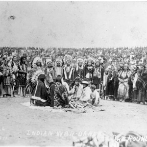
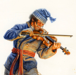
Slo-ce-ac-cum (Palouse Indian, 1847)
Paul Kane (1810–1871)
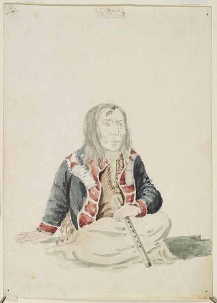
Watercolour and graphite on paper, 18.0 x 13.0 cm. Courtesy Royal Ontario Museum, https://rom.on.ca.
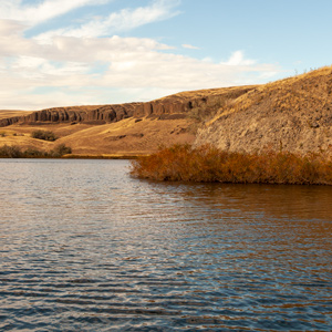
At the time of the Lewis and Clark Expedition, the Palouse Indians had coalesced around four primary villages on the lower Snake River: Wawaiwai, Almota, Penewawa, and Palus. Lewis and Clark estimated their population as 2,300 which included Northern Nez Perces.[1]Moulton, Journals, “Estimate of Western Indians,” 6:474.
About Slo-ce-ac-sum (see Figure), the Paul Kane wrote:
We swam our horses at the mouth of the Pelouse River, where it empties itself into the Nezperees [Snake River]. The Chief of this place is named Slo-ce-ac-cum. He wore his hair divided in long masses, stuck together with grease.[2]Paul Kane, Wanderings of an Artist among the Indians of North America . . . (London: Longman, Brown, Green, Longmans, and Roberts, 1859), 274.
Selected Encounters
October 11, 1805
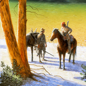
Down the Snake River

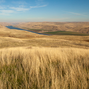
Almota, WA The paddlers navigate numerous Snake River rapids where the Nez Perce and Palouse have established fisheries. They buy salmon and dogs and notice a curious sweat lodge. In Santa Fe, the governor organizes a Spanish force to stop the expedition.
October 12, 1805
Snake River rapids
Riparia, WA The paddlers find good water on the Snake River and make about thirty miles before stopping at a long rapid at present-day Riparia. They describe Palouse villages and find that Sacagawea “reconsiles all the Indians, as to our friendly intentions.”
October 13, 1805
Fast water
Near Ayer, WA To start the day, the non-swimmers portage rifles and scientific equipment while the boatmen navigate a long Snake River rapid. In the evening, they run a two-mile rapid which “ran like a mill race.” In Santa Fe, a Spanish governor gives instructions to stop the expedition from returning.
October 14, 1805
'Ship Rock'
Burr Canyon, WA After passing a ‘ship rock’ Ordway’s canoe gets stuck on a rock and fills with water. They stop for the day and begin drying wet items. Vial leaves Santa Fe with orders to prevent the Lewis and Clark Expedition from succeeding.
October 15, 1805
Snake River rapids
Fishhook Rapids, WA While items are dried, the hunters and Lewis explore the plains above the Snake River. Some items are put away wet before the paddlers continue through several difficult rapids.
October 16, 1805
A musical welcome
Snake and Columbia rivers, WA The paddlers negotiate the last of the Snake River rapids and arrive at the Columbia River where they are given a musical welcome from a large group of Yakamas and Wanapums. They give the Indians tobacco, peace medals, and other gifts.
October 17, 1805
Snake and Columbia observations
Snake and Columbia rivers, WA On a clear morning, the captains take lunar observations. Clark is escorted about ten miles up the Columbia where he notes Indian ways and salmon habitats. Lewis takes an Indian vocabulary from the Wanapum and Yakama Indians.
October 18, 1805
Down the Columbia
Wallula Gap, WA The captains council with the Wanapums and Yakamas and records Sahaptian vocabularies. Clark measures the widths of the Snake and Columbia rivers. Late in the day, the expedition heads down the Columbia.
June 8, 1806
Playing prisoner's base
Several Nez Perce people visit, and to get the men in shape, foot races are run, and prisoner’s base is played. The sunken canoe is raised, and three horses are traded. The day ends with dancing.
July 4, 1806
Dangerous roads
Lewis travels east on “Cokahlahishkit”—the Road to the Buffalo—along the Blackfoot River. Clark travels south up the Bitterroot River and celebrates the Fourth of July with a “Sumptious Dinner”.