Joseph Mussulman
Marc A. Hefty photo.

Photo by Bill Bevis.
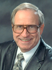
Left to right: Two concerned dugout canoe owners, one concerned expert paddler, and Joe grinning with delight
Joseph A. Mussulman (1928–2017) was the founding producer, editor and writer for Discovering Lewis & Clark. After five years of preparation and experimentation the website went online in 1998, under the auspices of a non-profit entity called VIAs Inc., and funded by grants from various sources, especially–throughout the bicentennial observance from 2003 to 2006–the Challenge Cost Share Program of the National Park Service. In 2009 the site was taken over by the Lewis & Clark Fort Mandan Foundation of Washburn, North Dakota.
Dr. Mussulman earned his bachelor’s and master’s degrees in music history and literature at Northwestern University in 1950 and 1951. As a Danforth Scholar he earned a doctorate in humanities from Syracuse University in 1967.
He has written and produced a number of interpretive programs in collaboration with audio specialist Richard H. Kuschel, also of Missoula Montana. In 1986, he wrote, narrated, and co-produced a multimedia presentation for the Blaine County Museum (MT) titled Forty Miles from Freedom, about the Non-Treaty Nez Perce Indians’ final battle with the U.S. Army, at the Bear Paw Mountains in 1877. In 2012-13 Mussulman and Kuschel revised the 20-minute onsite production and updated it in High Definition video. In 1994 their interactive self-guided audio-CD tour of Yellowstone National Park, a five-hour program produced for Tour Technologies, Inc., received first prize in the category of media productions from the National Association for Interpretation. Their Two Days to Destiny, an audio interpretive tour of the Little Bighorn Battlefield, won first place from the NAI in 1995.
Mussulman is the author of five articles on Lewis and Clark that appeared in We Proceeded On, the official journal of the Lewis and Clark Trail Heritage Foundation, Inc.: “My Boy Pomp’: About That Name,” Vol. 21, No. 2 (May 1995); “Soundscapes: The Sonic Dimensions of the Lewis and Clark Expedition,” Vol. 21, No. 4 (November 1995); “Men in High Spirits: Humor on the Lewis and Clark Trail,” Vol.22, No. 2 (May 1996); “‘In Greatest Harmoney’: ‘Meddicine Songs’ on the Lewis and Clark Trail,” Vol. 23, No. 4 (November 1997); and “Pomp’s bier was a bar,” Vol. 27, No. 1 (February 2001).
Dr. Mussulman has designed and produced maps for various books, brochures and study guides about Lewis and Clark, including 58 full-color maps illustrating the expedition’s entire route from coast to coast for the travelers’ guide, Along the Trail with Lewis and Clark, by Barbara Fifer and Vicky Soderberg (2nd ed., Helena: Montana Magazine, 2001). Those maps also appeared in the same publisher’s annual Lewis and Clark Travel Planner and Guide. They may be seen in Discovering Lewis & Clark at Discovering Lewis & Clark from the Air. In 1998, he created a poster illustrating the trail from Washington, D.C. to the Pacific, for Farcountry Press.
His other publications include a biography, Dear People . . . Robert Shaw (Indiana University Press,1979; reprint, Chapel Hill, NC: Hinshaw Music, 1996), and Music in the Cultured Generation (Evanston: Northwestern University Press, 1974). From 1987 through 1998 he was the interpretive writer and designer of Montana Afloat, a series of sixteen maps of Montana’s major floatable rivers.
Dr. Mussulman was a 1999 recipient of a Montana Governor’s Arts Award. Several years later he received an award of meritorious achievement from the Lewis and Clark Trail Heritage Foundation “for outstanding contributions in bring to this nation a greater awareness and appreciation of the Lewis and Clark expedition.” In 2005, he received the Montana Governor’s Humanities Award.
Contributions to this Site
Dung Beetles
by Joseph A. Mussulman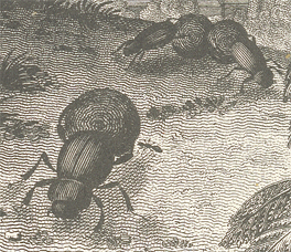
In his 261-word catalog of the insects, Lewis wrote that “a great variety of beatles common to the Atlantic states are found here likewise,” except that “the black beatle usually [c]alled the tumble bug which are not found here.”
Larocque at Fort Mandan
by Joseph A. Mussulman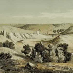
In the fall of 1804, Larocque’s job was to take a supply of North West Company merchandise to the Mandan and Hidatsa villages and trade for furs. While there, he asked the captains if he could join the expedition.
Long-tailed Weasels
Mustela frenata
by Joseph A. Mussulman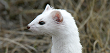
The captains saw their first white weasel at Fort Mandan on 9 November 1804. At Fort Clatsop on Christmas Day, 1805, Sacagawea gave Clark “2 Doz wesels tales.”
Bull Boats
Sgt. Pryor's Yellowstone voyage
by Joseph A. Mussulman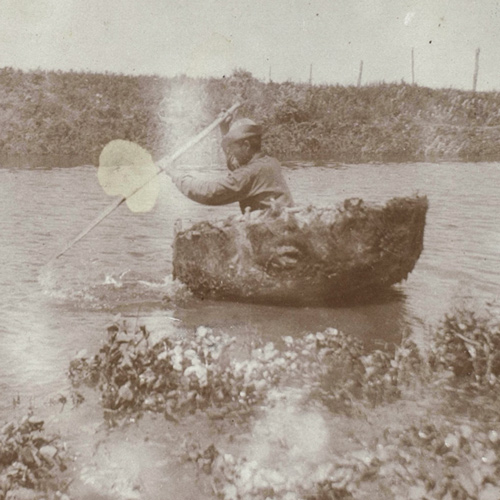
Indians stole all the horses, so Sgt. Pryor and his three privates constructed two bull boats and floated down the Yellowstone River in hopes of catching up with Clark or Lewis.
Pompeys Pillar by Air
Remarkable rock
by Joseph A. Mussulman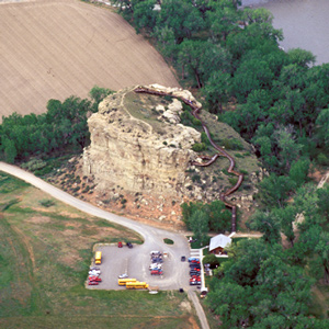
For countless generations this conspicuous sandstone formation had been a distinctive feature in the homeland of the Crows.
Local Recollections
Wheeler's inquiries
by Joseph A. Mussulman
Around 1900, Olin D. Wheeler, initiated an inquiry into the source and meaning of the name Lolo. He secured the aid of Judge Frank Woody of Missoula, who in turn discussed the matter with some other “old-timers.”
Making Leather
by Joseph A. Mussulman
“The men of the garison are still busily employed in dessing Elk’s skins for cloathing.” Regrettably, Lewis was compelled to add that “they find great difficulty for the want of branes [brains].”
Bitterroot Grizzlies
Lewis's summary and recent insights
by Charles Jonkel, Joseph A. Mussulman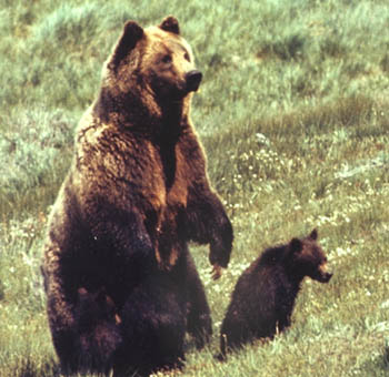
It wasn’t until May 1806 that Lewis had occasion to expand on his Fort Clatsop Grizzly Bear observations. This article adds recent insights and an interview with Charles Jonkel.
The Salmon and Snake Villages
Side trip
by Joseph A. Mussulman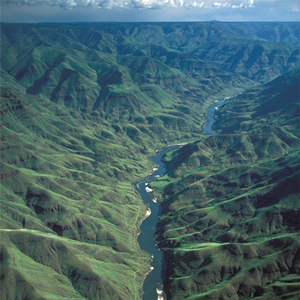
When the captains saw Nez Perces with several fresh chinook salmon, “fat and fine,” which the Indians said came from “Lewis’s River,” known today as the Salmon River, they dispatched Sgt. John Ordway and two privates to buy some.
Grouse
by Joseph A. Mussulman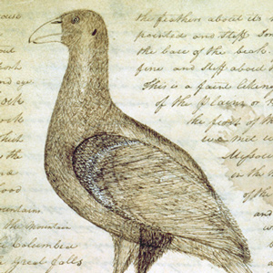
Why did Lewis call the spruce grouse, blue grouse, and Oregon ruffed grouse “Three species of Pheasants?” What species did he actually see?
Tucannon and Palouse Rivers
"rugid rocks"
by Joseph A. Mussulman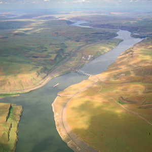
Now they entered a four-mile-long torrent, its climax a “narrows or narrow rapid” through which a channel 25 yards wide was confined between “rugid rocks” for a solid mile and a half.
Walnut Street Prison and A.M.E. Church
Ironic juxtaposition
by Charles F. Reed, Joseph A. Mussulman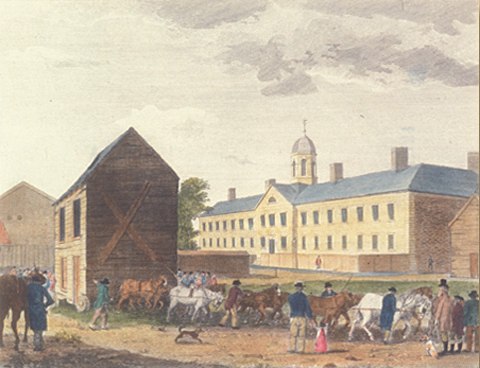
The irony inherent in the juxtaposition of the A.M.E. Church’s prime sanctuary as a symbol of fellowship and hope, with the Walnut Street Gaol (jail) as a place of isolation and despair, would not have been lost on any black person or white abolitionist.
Estimate of the Eastern Indians
Early intelligence report
by Joseph A. Mussulman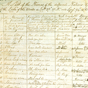
The expedition had one major outcome that was made available to the public well before the expedition was over, the “Estimate of the Eastern Indians,” which Lewis and Clark sent back on the barge in April 1805.
Packer Meadows
"A pretty little plain"
by Joseph A. Mussulman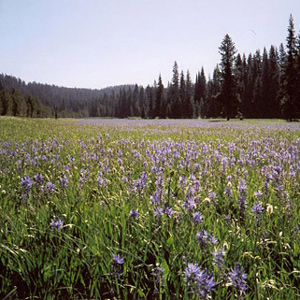
Lewis acknowledged it was “a pretty little plain of about 50 acres plentifully stocked with quawmash” and “one of the principal stages or encampments of the indians”
Mapping the Lolo Trail
by Joseph A. Mussulman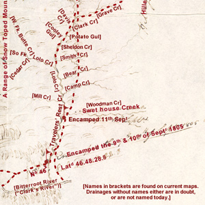
Clark did not randomly insert wiggly lines merely to hint at the topography around K’useyneiskit. By comparing his sketches with a modern USGS map we can make reasonably good guesses as to what drainages he actually saw.
The Falls of the Missouri
by Joseph A. Mussulman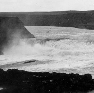
From Indian information the previous winter, the captains knew they would encounter a great falls in the Missouri River. What they found was a 14-mile-long series of waterfalls and rapids that drops 473 feet.
Recognizing Divine Providence
Did they pray?
by Joseph A. Mussulman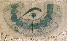
Did they pray? The answer is yes, they did—to invoke the catch-phrase their journalists sometimes used to generalize about the habits of others—”in their way.”
The Expedition’s Flags
by Joseph A. Mussulman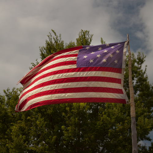
The expedition’s supplies included an unknown number of American flags. Those that the journals refer to only as being “of second size,” and “of third size,” were given to selected Indian leaders as tokens of peace.
Thomas Howard
Private
by Barbara Fifer, Joseph A. Mussulman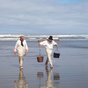
On 23 January 1806, Lewis dispatched Howard and Werner to the Salt Camp on the ocean beach, to bring back a supply of salt. When they had not returned by the 26th, Lewis feared they had gotten lost.
Friedrich Wilhelm von Steuben (1730–1794)
Early American Army trainer
by Joseph A. Mussulman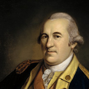
Until he presented his services to General Washington at Valley Forge, the Continental Army still consisted merely of a number of state-sponsored militias that were entirely independent of one another, each operating according to its own rules and regulations.
Passing Hell’s Gate
Up the Blackfoot River
by Joseph A. Mussulman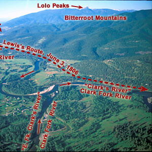
The continuation of the Northern Nez Perce Trail led from their camp at Travelers’ Rest to the plains near the Great Falls of the Missouri, saving hundreds of miles from the expedition’s 1805 route.
Bearberry
Kinnikinnick, Arctostaphylos uva-ursi
by James L. Reveal, Joseph A. Mussulman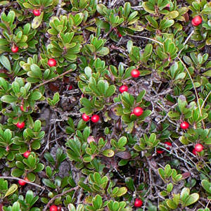
Lewis and Clark sometimes called it kinnikinnick, sometimes sacacommis. At Fort Clatsop on 29 January 1806, he described this useful plant.
Clarkia
Clarkia pulchella
by James L. Reveal, Joseph A. Mussulman, Kristopher K. Townsend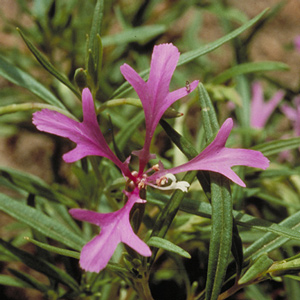
The plant’s common names include elkhorn, ragged robin, pink fairy, and deerhorn. In the spring of 1807 Lewis turned over his plant specimens to Frederick Pursh, who gave this flower the scientific name Clarkia pulchella
Square Butte
Lewis's Fort Mountain
by Joseph A. Mussulman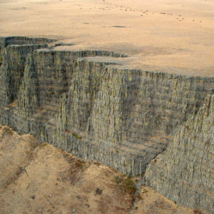
“This mountain has a singular appearance. it is situated in a level plain, it’s sides stand nearly at right angles with each other and are each about a mile in extent … from it’s figure we gave it the name of fort mountain.”
Clatsop Cone Hats
by Joseph A. Mussulman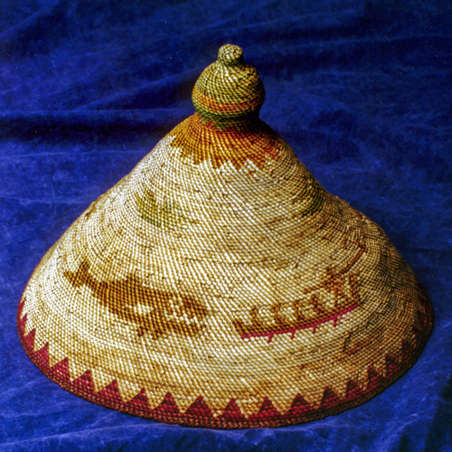
They could come up with nothing in the way of hats that was as practical as the style perfected by the Clatsops and Chinooks.
Reunion
Lewis and Pryor catch up
by Joseph A. Mussulman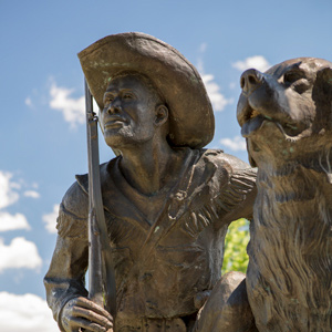
After splitting up into five separate details over five weeks earlier, all the members of the Corps of Discovery were finally reunited 142 miles downriver from the mouth of the Yellowstone.
Meeting the Snake
Water color
by Joseph A. Mussulman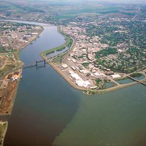
The Corps’ four-day trip to this point from Canoe Camp on the Clearwater in their five crowded dugouts was a taste of things to come.
Mountain Beavers
Aplodontia rufa (Sewelel)
by Joseph A. Mussulman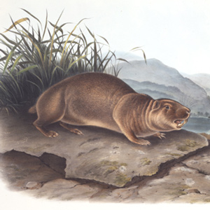
This secretive, primitive little rodent, which somewhat resembles the woodchuck and the muskrat, belongs to the same mammalian order, Rodentia, as the beaver, Castor canadensis, but otherwise they have nothing in common.
Malta Bend
"butifull prarie"
by Joseph A. Mussulman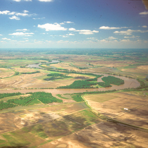
On 16 June 1804, Clark took a long walk through a “butifull extensive Prarie” to look for an old fort on Evans’s map, built by the French thereabouts more than eighty years earlier. The party spent three days here making new oars and ropes, and hunting.
The Newfoundland Dog
Seaman's breed
by Joseph A. Mussulman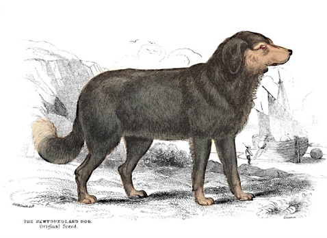
The original Newfoundland was smaller, the body more slender, forehead more arched, the muzzle sharper, and “nearly all of a totally black colour, excepting a bright rust coloured spot above each eye.”
The Bears Tooth
Key landmark on the Old North Trail
by Joseph A. Mussulman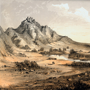
The Bears Tooth was an important landmark on the the ancient Indian road that has come to be known as the Old North Trail. It was included on Nicholas King’s 1804 map, and the captains expected to find it.
Portable Inkwell
Their most important tool
by Joseph A. Mussulman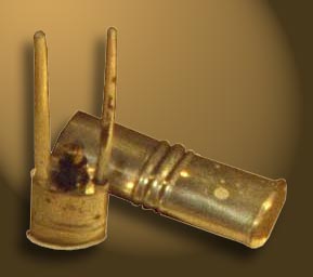
None of their tons of supplies, not even the guns, powder, and bullets with which they fed themselves, were ultimately as important as the pens, ink, and paper they carried, and protected from the elements.
Dyes and Shellac
by Joseph A. Mussulman
Fort Clatsop Elk
Cervus canadensis roosevelti
by Greg Tollefson, Joseph A. Mussulman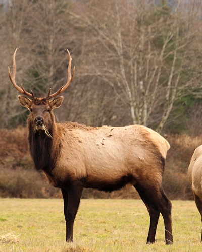
Fort Clatsop’s location was chosen in part because, as some Clatsop Indians had advised the captains, there were more elk on the south side of the river than on the north. The subspecies found there was named in 1898 to honor Theodore Roosevelt.
The Clearwater Canoe Camp
by Joseph A. Mussulman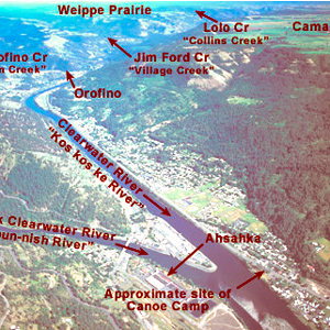
Still sick and exhausted from their recent crossing of the Bitterroot Mountains, Lewis, Clark, and their crew arrived on 26 September 1805, at what they called Canoe Camp, on the Clearwater River.
The Woodlands
Repository of plant specimens
by Catharine P. Fussell, Joseph A. Mussulman, Timothy Preston Long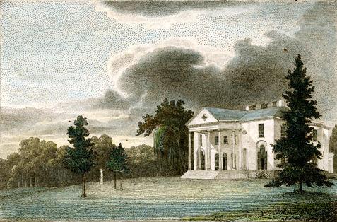
Lewis sent plant specimens to William Hamilton who cultivated them in his garden at The Woodlands outside of Philadelphia.
Daniel Boone
Long hunter role model
by Joseph A. Mussulman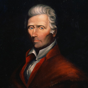
Daniel Boone was sixty-nine years old in 1803, too old to go traipsing out to the Pacific Ocean. But Lewis’s “qualifycations” suggest that Boone would have been precisely the kind of hunter he hoped to find.
Lower Portage Camp
Good news, bad news
by Joseph A. Mussulman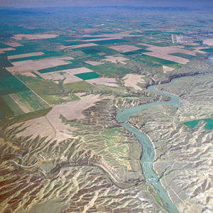
By the evening of 15 June 1805, Clark had gotten the canoes and the white perogue as close to the Great Falls as possible, and the next afternoon Lewis joined him at the “lower portage camp,” a mile below the mouth of Belt Creek.
Cape Disappointment
"This Emence Ocian"
by Joseph A. Mussulman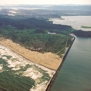
Private Whitehouse thought his captains had named Cape Disappointment “on account of not finding Vessells there,” but it had received the name years earlier.
Lolo’s Faith and Death
Clues about 'Laurence'
by Joseph A. Mussulman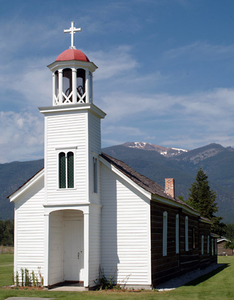
The closing of the first St. Mary’s Mission on 5 November 1850 was punctuated by the sudden death of “Lolo, the only Indian who still remained well disposed and really attached to religion.”
Mapping Siouxland
A cartographic palimpsest
by Joseph A. Mussulman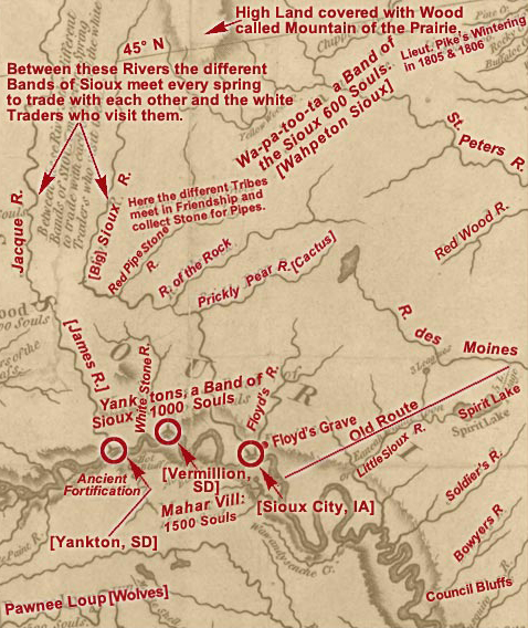
The historic Map of Lewis and Clark’s Track Across the Western Portion of North America can fruitfully serve as a major palimpsest of American history as of the year in which it was created, 1810.
La Véndrye’s Golden Sands
His visit to Spirit Mound
by Joseph A. Mussulman, Kristopher K. Townsend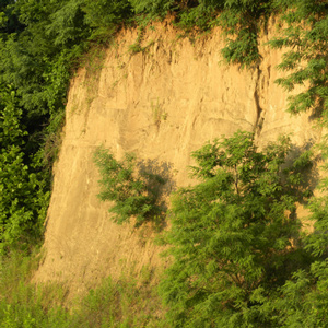
La Vérendrye’s 1728 name for Spirit Mound contains several puzzling statements. Pako’s reference to that “very fine gold-coloured sand,” suggests the “little mountain” was located in a fabulous land, an Eldorado, of precious natural riches.
Sage Grouse
Centrocercus urophasianus
by Joseph A. Mussulman, Mark Behan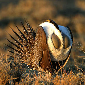
“The Heath Cock or cock of the Plains is found in the Plains of Columbia and are in great abundance from the enterance of Lewis’s river to the mountains which pass the Columbia between the Great falls and Rapids of that river.” Thus we have a historic account of sage grouse range and abundance.
Charles M. Russell NWR
Missouri Breaks
by Joseph A. Mussulman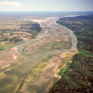
The wind against them again on 25 May 1805, the Corps had to tow their boats with ropes. Lewis observed, “the water run with great violence, and compelled us in some instances to double our force in order to get a perorogue or canoe by them.”
Wheeler’s Lolo Crossing
On the Northern Nez Perce Trail
by Barbara Fifer, Joseph A. Mussulman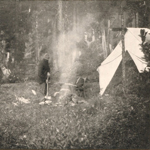
One of Wheeler’s most successful efforts to amplify any part of Lewis and Clark’s route was his exploration of the Lolo Trail. For that he relied heavily on Elliott Coues’ 1893 annotations to the expedition’s narrative.
Indian Commissions
Tools of diplomacy
by Joseph A. Mussulman
Each peace medal given out was usually accompanied by a commission, also called a parole, which is the French word for promise..
Clark’s Apsáalooke (Crow) Speech
A speech never given
by Joseph A. Mussulman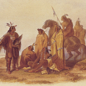
While stinging from having so many of his horses stolen, Clark wrote a speech to the Crow Indians imploring them to return the booty. After all, he needed those horses to complete the captain’s bold diplomatic plan.
The Lewis and Clark River
Coast Range winter
by Joseph A. Mussulman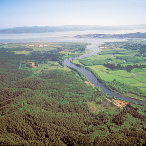
During their time at the coast, the Corps saw only six sunny days; the rest brought clouds, fog, rain, and a little snow. Fifty-three were partly clear. That’s a normal winter on the west slopes of the Coast Range.
Charles B. J. F. de Saint Mémin
Early American portraitist
by Joseph A. Mussulman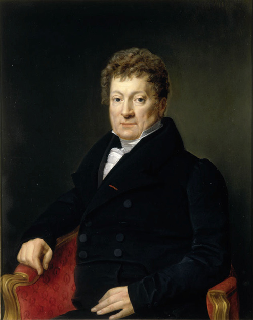
Charles Balthazar Julien Févret de Saint-Mémin (1770–1852) was a portrait artist whose works include Lewis, Clark, Chief Sheheke and his wife Yellow Corn.
Three Forks of the Missouri
Essential geographic point
by Joseph A. Mussulman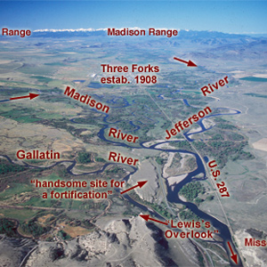
Lewis and his canoes slowly approached the forks, “the current still so rapid that the men are in a continual state of their utmost exertion to get on, and they begin to weaken fast from this continual state of violent exertion.” He described the “extensive and beatifull plains and meadows.”
Experience the Lewis and Clark Trail
The Lewis and Clark Trail Experience—our sister site at lewisandclark.travel—connects the world to people and places on the Lewis and Clark Trail.
Discover More
- The Lewis and Clark Expedition: Day by Day by Gary E. Moulton (University of Nebraska Press, 2018). The story in prose, 14 May 1804–23 September 1806.
- The Lewis and Clark Journals: An American Epic of Discovery (abridged) by Gary E. Moulton (University of Nebraska Press, 2003). Selected journal excerpts, 14 May 1804–23 September 1806.
- The Lewis and Clark Journals. by Gary E. Moulton (University of Nebraska Press, 1983–2001). The complete story in 13 volumes.
This site is provided as a public service by the
Lewis and Clark Trail Alliance
with additional funding from the following: