Having passed the Falls of the Ohio yesterday, Clark and Lewis continue preparing for departure. Neither captain appears to be keeping a journal during this time, but other travelers offer their opinion on the view from Louisville.
Magnificence and Grandeur
The “Falls” of the Ohio River
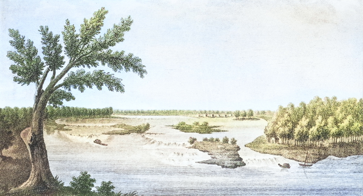
Colorized from an original map by Victor Collot, A Journey in North America (1796), plate 18. Courtesy East Tennessee State University.
Here the magnificence of the river; the grandeur of the falls; the unceasing, yet pleasing murmur of the cataract, and the beauty of the surrounding prospect, all contribute to render the situation of the place truly delightful, and to impress every man of observation who beholds it, with ideas of its future importance, when the trivial causes which at present give rise to its character of unhealthiness, so easily to be removed, shall entirely be done away.
Zadok Cramer[1]Zadok Cramer, The Ohio and Mississippi Navigator: Containing Directions for Navigating the Monongahela, Allegheny, Ohio and Mississippi Rivers . . . (Pittsburgh: Zadok Cramer, Bookseller & … Continue reading
Louisville
Louisville is most delightfully situated on an elevated plain to which the ascent from the creek and river is gradual, being just slope enough to admit of hanging gardens with terraces . . . .
—Fortescue Cuming, 10 May 1808[2]Fortescue Cuming, Sketches of a Tour to the Western Country: Through the States of Ohio and Kentucky, a voyage down the Ohio and Mississippi rivers, and a trip through the Mississippi territory, and … Continue reading
Jeffersonville
Looking upwards, a reach of five or six miles presents itself, and turning the eye to the left, Jeffersonville, a neat village of thirty houses, in Indiana, about a mile distant, is next seen. The eye still turning a little more to the left, next rests upon a high point where general Clark first encamped his little army, aboot thirty years ago, when he descended the river to make a campaign against the Indians, at which time Louisville, and almost the whole of Kentucky was a wilderness covered with forests.
—Fortescue Cuming[3]Ibid.
Clarksville
Clarksville, a new village in Indiana at the lower end of the rapids, is next seen, beyond which Silver creek hills, a moderately high and even chain, bound the view five or six miles distant.
—Fortescue Cuming[4]Ibid.
The Rapids
The rapids or falls (as they are called) of the Ohio, are the next objects which strike the observer. They are formed by a range of rocks and low islands, which extend across the river, the deepest channel through which is near the Indiana shore, and has only six feet water, and that even very narrow when the river is low. The fall here has been proved by a level to be twenty-two inches [feet] and a half in two miles, from Bear Grass creek to Shipping Port, which causes a velocity of current of about twelve miles an hour in the channel.
—Fortescue Cuming[5]Ibid.
Experience the Lewis and Clark Trail
The Lewis and Clark Trail Experience—our sister site at lewisandclark.travel—connects the world to people and places on the Lewis and Clark Trail.
Plan a trip related to October 16, 1803:

Notes
| ↑1 | Zadok Cramer, The Ohio and Mississippi Navigator: Containing Directions for Navigating the Monongahela, Allegheny, Ohio and Mississippi Rivers . . . (Pittsburgh: Zadok Cramer, Bookseller & Stationer, 1802), 37. |
|---|---|
| ↑2 | Fortescue Cuming, Sketches of a Tour to the Western Country: Through the States of Ohio and Kentucky, a voyage down the Ohio and Mississippi rivers, and a trip through the Mississippi territory, and part of West Florida, commenced at Philadelphia in the winter of 1807… (Pittsburgh: Cramer, Spear, & Eichbaum, 1810), 234, available at www.archive.org/details/sketchesoftourto00cumi. |
| ↑3 | Ibid. |
| ↑4 | Ibid. |
| ↑5 | Ibid. |