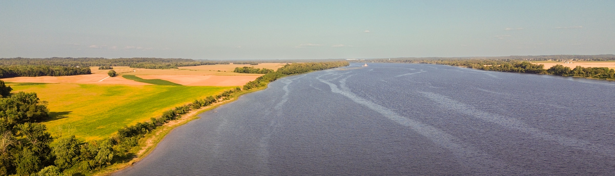
On or near this date, the expedition reaches the region where the hills recede, and the Ohio River lowlands commence. One week earlier, Thomas Rodney‘s batteaux ran aground in a channel with only three inches of water—a certain challenge for the expedition’s barge.
Ohio River Lowlands near Grandview, Indiana
© 2024 by Richard Hunt. Used by permission.
The Lowlands Commence
Between Hardin’s creek and Yellow banks the low lands commence. The hills which higher up the river are uniformly to be met with either on one side or the other, now entirely disappear, and their is nothing to be seen on either hand but an extensive level country
Zadok Cramer, 1802[1]Zadok Cramer, The Ohio and Mississippi Navigator: Containing Directions for Navigating the Monongahela, Allegheny, Ohio and Mississippi Rivers . . . (Pittsburgh: Zadok Cramer, Bookseller & … Continue reading
A Great Herculean Labor
In this reach we left the last of the mountains on the Ky. shore behind us; thus we have accomplished this great Herculean labor of throwing the mountains behind us, for we had left them before on the NW shore in the rocky reach before mentioned.
Nothing now but level country appears before us where we expect to be more favord by the winds than we have been, tho yesterday and today we cannot complain.
—Thomas Rodney, 23 October 1803[2]Dwight L. Smith and Ray Swick, ed., A Journey Through the West: Thomas Rodney’s 1803 Journal from Delaware to the Mississippi Territory (Athens: Ohio University Press, 1997), 132.
Three Inches Deep
[F]ound a sandy riffle on our right between us and NW shore, and after gitting 2/3 through the reach grounded. Got off and went forward again. Got near the lower end the riffle which was only soft sand and ground again. All hands turned out to git her off but found we could not git her over, there not being more than 3 inches water. All hands spread round to hunt a channel, and [we spent] an hour before we discovered a passage. We had to go back about 200 yards.
—Thomas Rodney, 23 October 1803[3]Rodney, Journal, 133.
Experience the Lewis and Clark Trail
The Lewis and Clark Trail Experience—our sister site at lewisandclark.travel—connects the world to people and places on the Lewis and Clark Trail.
Plan a trip related to October 30, 1803:
Notes
| ↑1 | Zadok Cramer, The Ohio and Mississippi Navigator: Containing Directions for Navigating the Monongahela, Allegheny, Ohio and Mississippi Rivers . . . (Pittsburgh: Zadok Cramer, Bookseller & Stationer, 1802), 37. |
|---|---|
| ↑2 | Dwight L. Smith and Ray Swick, ed., A Journey Through the West: Thomas Rodney’s 1803 Journal from Delaware to the Mississippi Territory (Athens: Ohio University Press, 1997), 132. |
| ↑3 | Rodney, Journal, 133. |